Georgia is a land of lively rivers, emerald lakes, and, of course, waterfalls! We have a passion for ice climbing, constantly exploring new spots whenever possible. Here, I gather information about ice climbing locations and current conditions.
Here are some of our discoveries, more spots can be found on Google Maps below.
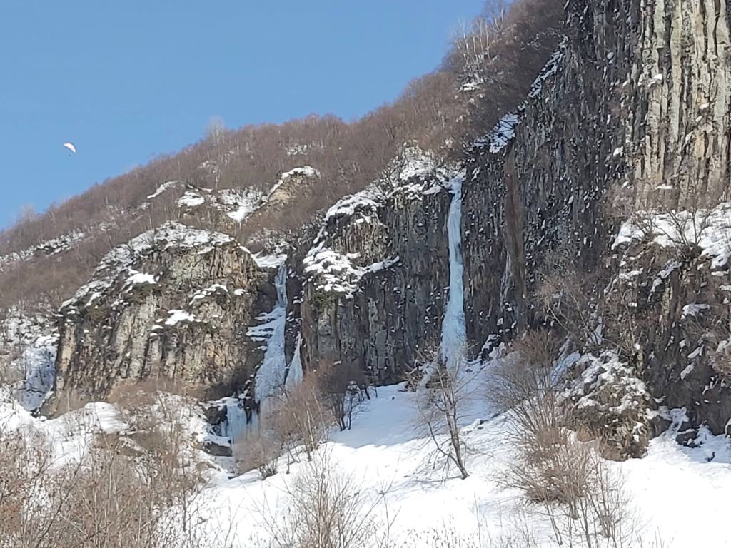
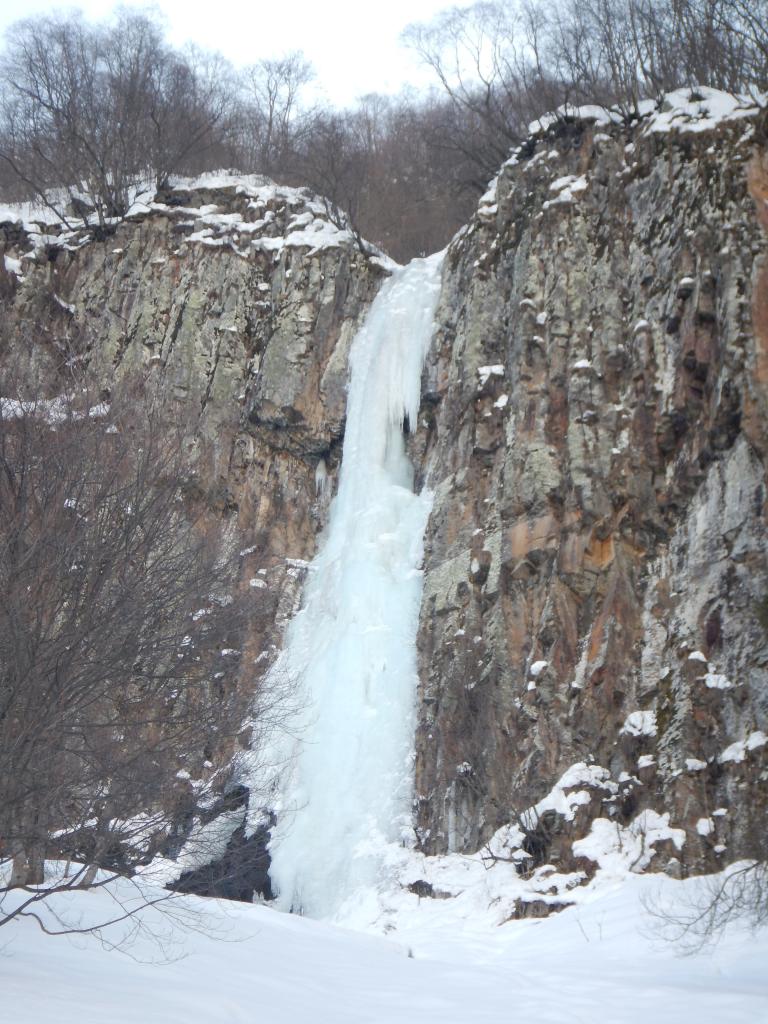
Perfect View, WI2-WI5, 30m
You can find several lines with different difficulty.
This waterfall has one pitch of 30 meters in height, but it’s very wide and provides many variants for climbing experiments.
The easiest line is located on the right side and goes on beautiful cauliflower. Cauliflower formations always look easy, but often could be tricky. In any case, this line is no more than W3+. Also, an easy line is located from the left, but there is a huge bergschrund below the ice, so it may be not accessible right now. More difficult lines are located in the central part. This waterfall requires very cold temperatures to freeze properly.
You can enjoy an exceptional view of Kazbek from the top!
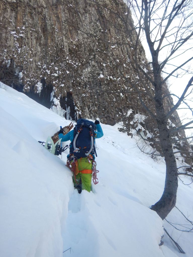
The approach took 45 minutes from the road. 1.8 km, but in deep snow. Strongly recommended to use snowshoes\skies.
📍Location:
Behind Koby pass. Can be seen from Kobi gondola: 42.5339611N, 44.4990064E

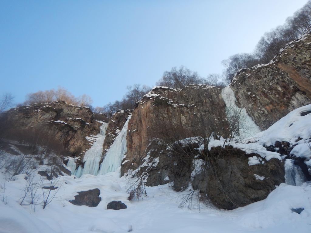
Sviana, WI3+, 30m
Very nice and not difficult waterfall, perfect for starting the season!
This waterfall has one pitch of 30 meters high, but it’s really cool
The easiest way is going from right and more difficult is going from left. In any case, the right line is no more than WI3+. Anchor station on ice, descend with Abalakov thread, but you can descend from the tree, located on the left side, not so far from the top
The approach is fantastic — only 5 minutes from the road! The road is always maintained in good condition.
📍Location:
In Khada gorge: 42.4560425N, 44.5286058E

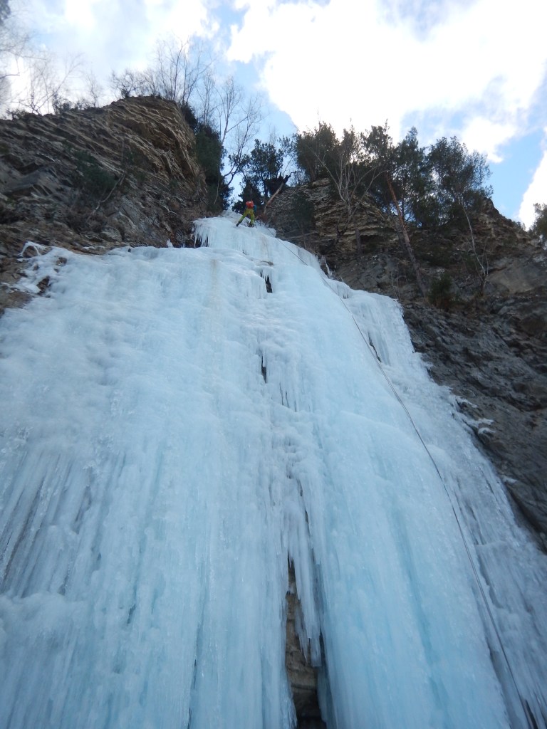
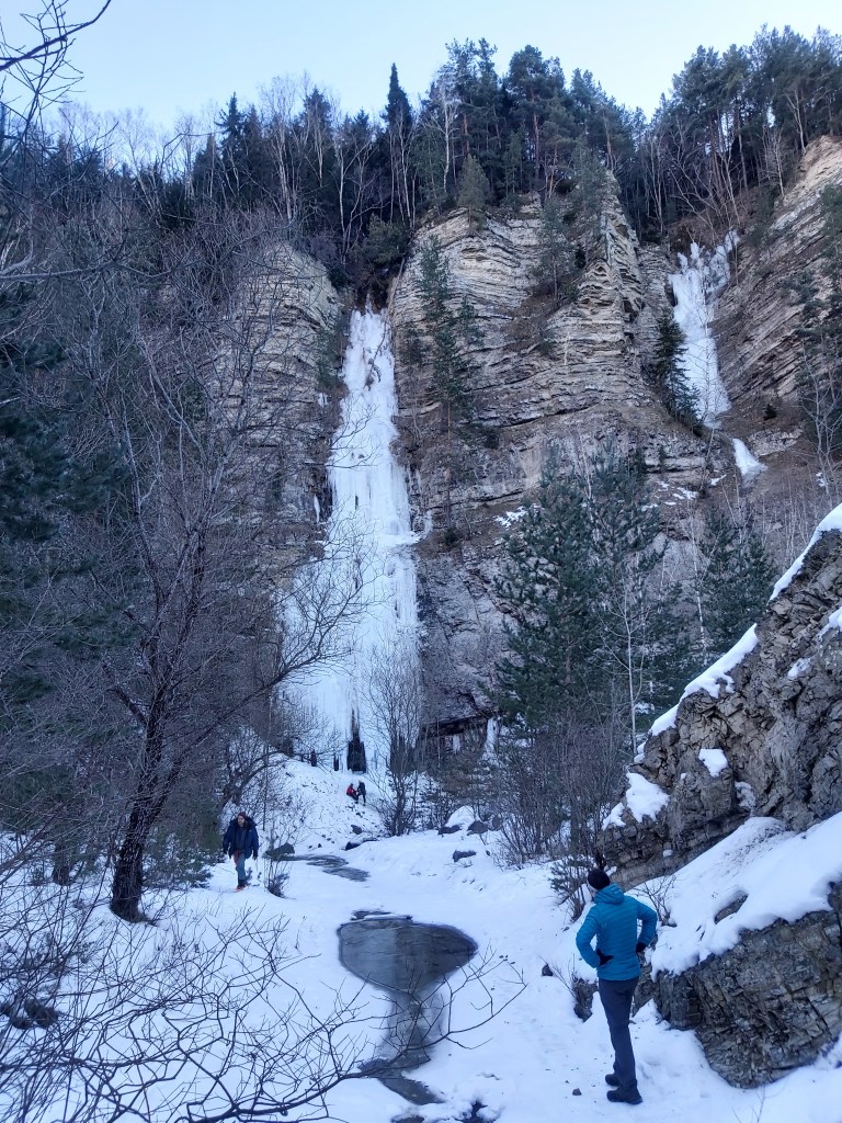
Nakhereti, WI4, 70m
At least 2 pitches on the way up (we did even 3 — 20/20/30). For the descent, we used a 60m rope (Abalakov thread)
This waterfall is a beauty located near the village of Tsdo and can be seen from the Terek viewpoint (check it out on Google Maps). The bottom part is tougher (around WI4) and the top is easier (WI3). Just beware, this waterfall gets sun around 1 PM and starts to melt, so it’s best to climb on a cloudy day or start early to finish before that time. There’s also an upper part for this waterfall just above the narrow ice bridge, at that point we stopped, but the ice was too thin for screws.
To get there, drive towards the border and look for the «Larsi tunnel» sign after you pass the village of Tsdo. Turn sharp right just before the tunnel and continue on the off-road path, passing through a wooden gate (this road is only for 4×4 vehicles). When the road ends, you’ll see the waterfall and can grab your gear and continue on foot. You can find the approach .gpx on wikiloc -> gobarlog.
❗Warnings:
Make sure to climb on a cloudy day or start early to avoid the waterfall’s sun exposure around 1 PM (starts actively melting)
📍Location of the waterfall: 42.6934903N, 44.6488042E
📍Carpark: 42.6961950N, 44.6447353E (the parking spot may be further away depending on snow conditions and your car ability)

Ghuda Pillars, WI5/WI4/WI5, 60m X 3
Ghuda Pillars are located in the canyon below the Monument of Peace near Gudauri and presented by 3 beautiful waterfalls
All of them have one pitch of about 60 meters in height
The easiest waterfall is in the middle, about WI4 (cauliflower). The right waterfall is WI5, and the left one is also. Ghuda Valley is a cold place, but be careful at the end of the season — in March sun is hot, and the upper part gets a lot of sun. I think these waterfalls are forming early — when night temperatures in Gudauri are stable below zero and not too hot during the day, it can be good for climbing. The are some trees in the upper part for descent (not for toprop). Usually (depending on snow) you can drive into the valley with a 4×4 car
The approach to the left and middle waterfalls is a little bit tricky — you should ascend to the right waterfall then go close to the rock left, and descend using the rope. You will climb up a little bit and then get to the middle waterfall. Approach .gpx can be found on wikiloc -> gobarlog. It can take up to 2 hours, depending on snow depth.
📍Location of the middle waterfall: 42.46672, 44.47581
📍Carpark: 42.46475, 44.47224
Feel free to share your own ice-climbing experiences and recommendations. Your insights can contribute to a vibrant community of enthusiasts, creating a valuable resource for fellow adventure seekers. Gratitude for any contributions! You can do that in any of the following ways: add a comment to this publication, write to me @hannainthemountains on Instagram or Telegram
Gallery


Conditions updates
| Updated | Waterfall | Conditions |
| 11 Feb | Gveleti | Right side collapsed, dangerous |
| 04 Feb 2024 | Biisi | Formed |
| 17 Feb 2024 | Ghuda Pillars | Significantly melted, not climbable |
| 05 Jan 2024 | The right side collapsed, dangerous | Not formed |
| 30 Dec 2023 | Perfect View | Not formed |
Больше на Climb4Life
Подпишитесь, чтобы получать последние записи по электронной почте.

Оставить комментарий